Strategic Housing Land Availability Assessment (SHLAA)
As part of the South Oxfordshire District Council Strategic Housing Land Availability Assessment (SHLAA) - 15 sites have been identified in and around the study area as having housing potential.
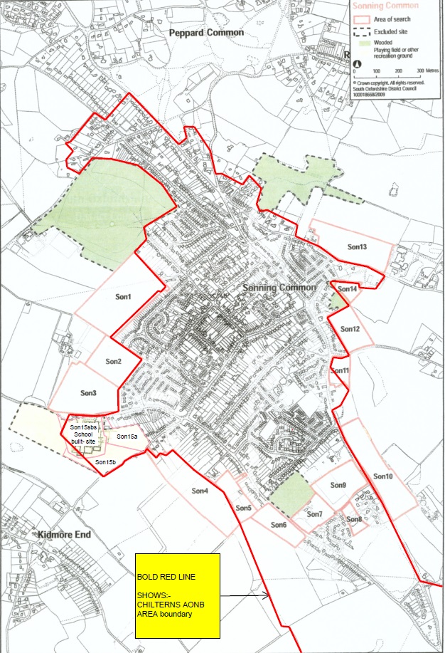
below is a map showing all 15 sites (known as SON sites)
Click below to view the SON site in more detail:
| SON1 | SON3 | SON5 | SON7 | SON9 | SON11 | SON13 | SON15A |
| SON2 | SON4 | SON6 | SON8 | SON10 | SON12 | SON14 | SON15B |
These sites have been extensively surveyed as part of the Neighbourhood Development Plan preparation process.
The survey results were presented at public meetings, with further opportunity being given for comment from the community and other stakeholders. Some of these sites have now been withdrawn from NDP consideration by their owners.
It should be emphasised that the Neighbourhood Development Plan process is not just about housing potential, unlike the SHLAA, as there is an obligation to consider many other land use functions within the planning process. These include community needs with regard to, but not limited to: educational and healthcare facilities, sports and recreation, public open space, office and commercial provision, transport requirements etc.